Loading...
")
")
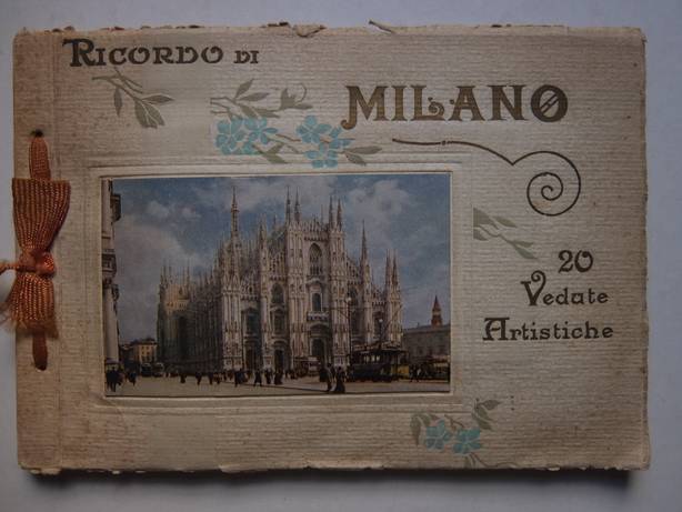
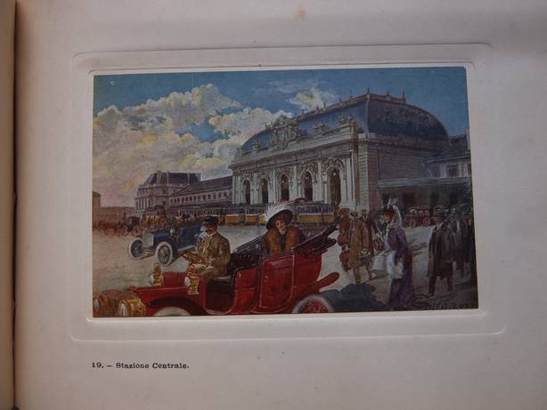
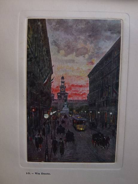
N.n.. Ricordo di Milano. 20 Vedute Artistiche. S.l.; s.a. (ca. 1920); softcover, bound with cord; frontcover with floral decoration; oblong; 20 mounted plates in colour. Fine copy. [34099]
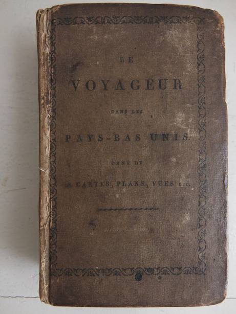
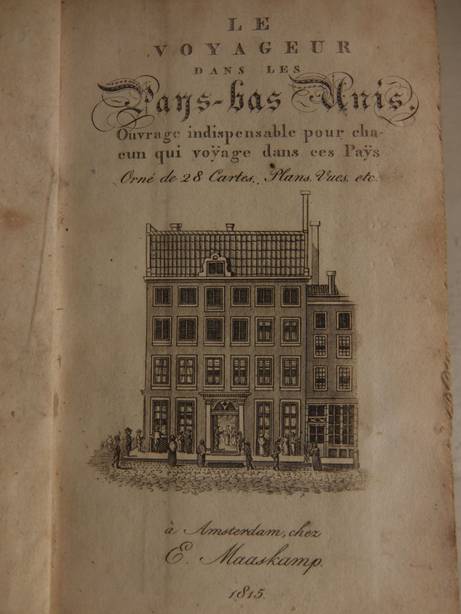
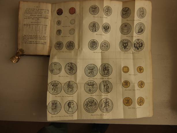
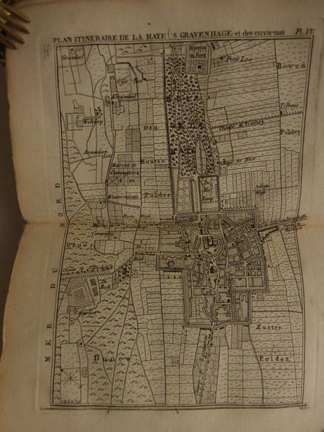
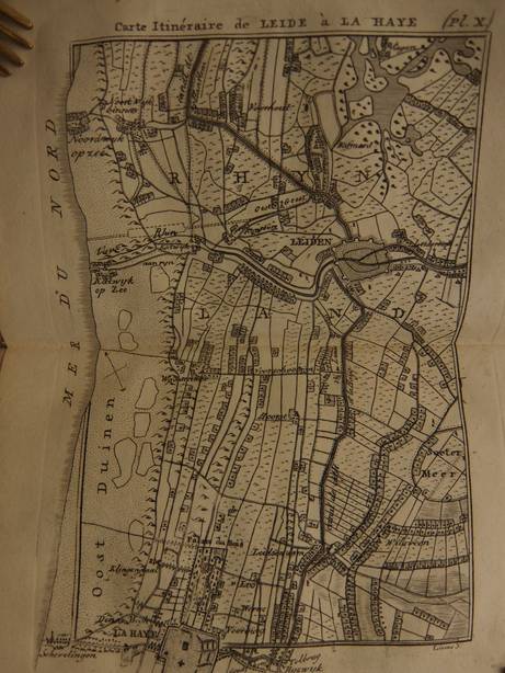
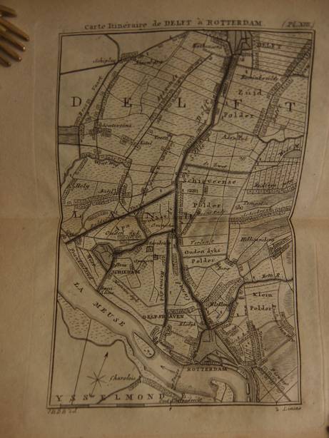
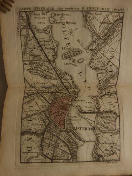
N.n.. Le voyageur dans les Pays-bas Unis. Ouvrage indispensable pour chacun qui voyage dans ces Pays. Orné de 28 Cartes, Plans, Vues, etc. Amsterdam; 1815; E. Maaskamp. Engraved titlepage and 22 engravings (maps, plans and 3 other engravings). Original cardboard; 380, XXII, (10) pp. Complete copy. Titlepage indicates 28 cartes, etc. but the table of contents at the back indicates 22 engravings. Binding has signs of wear. [32887]
N.n..
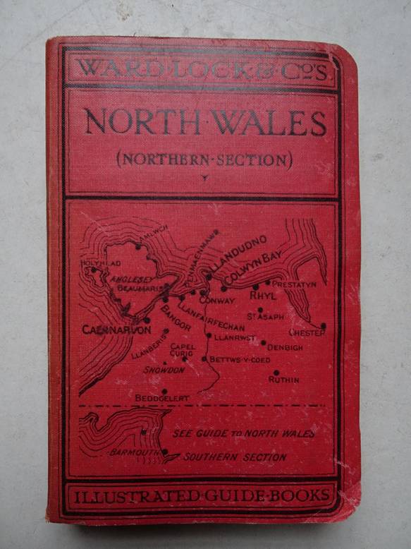
A pictorial and descriptive guide to North Wales ( Northern Section). Six district maps and plans of Rhyl, Chester, Colwyn Bay, Llanduno, Conway, Bangor and Caernarvon.
London; s.a.; Ward, Lock & Co.; cardboard; with 60 ills.; 11th, revised, edition; ills.; index; 200 pp., followed by advertising.
Slight signs of use.
[35993]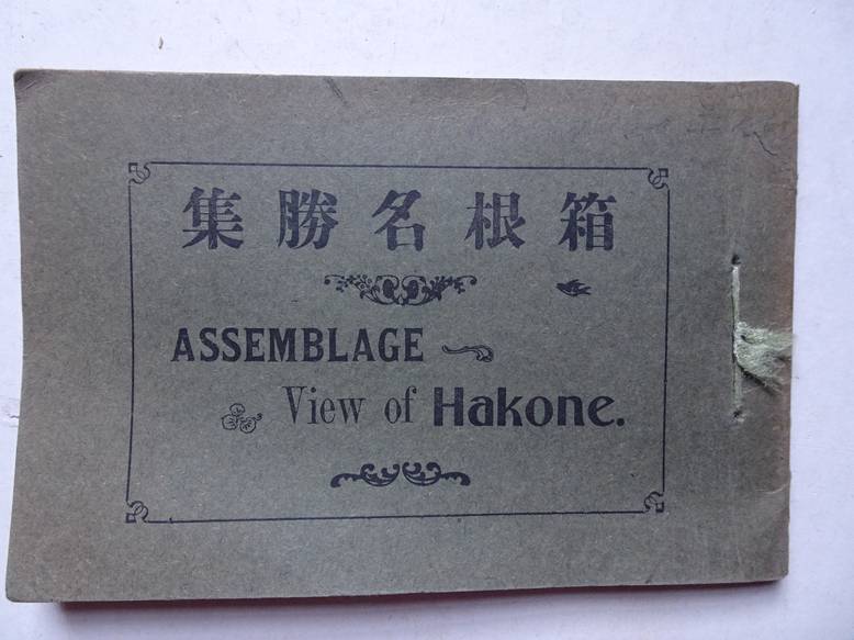
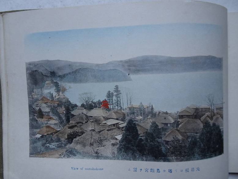
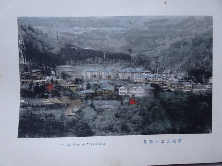
N.n..
Assemblage. View of Hakone.
S.l.; s.a. (ca. 1915); softcover; oblong; bound with string; 18x12 cm.; plates in colour; with captions in English and Japanese; not paged.
A trifle warped copy.
[35133]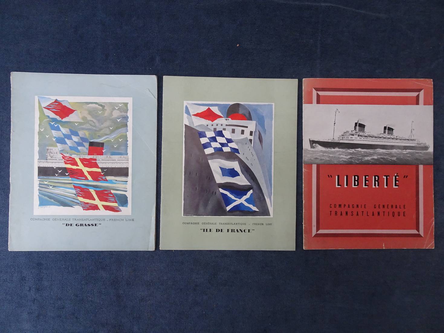
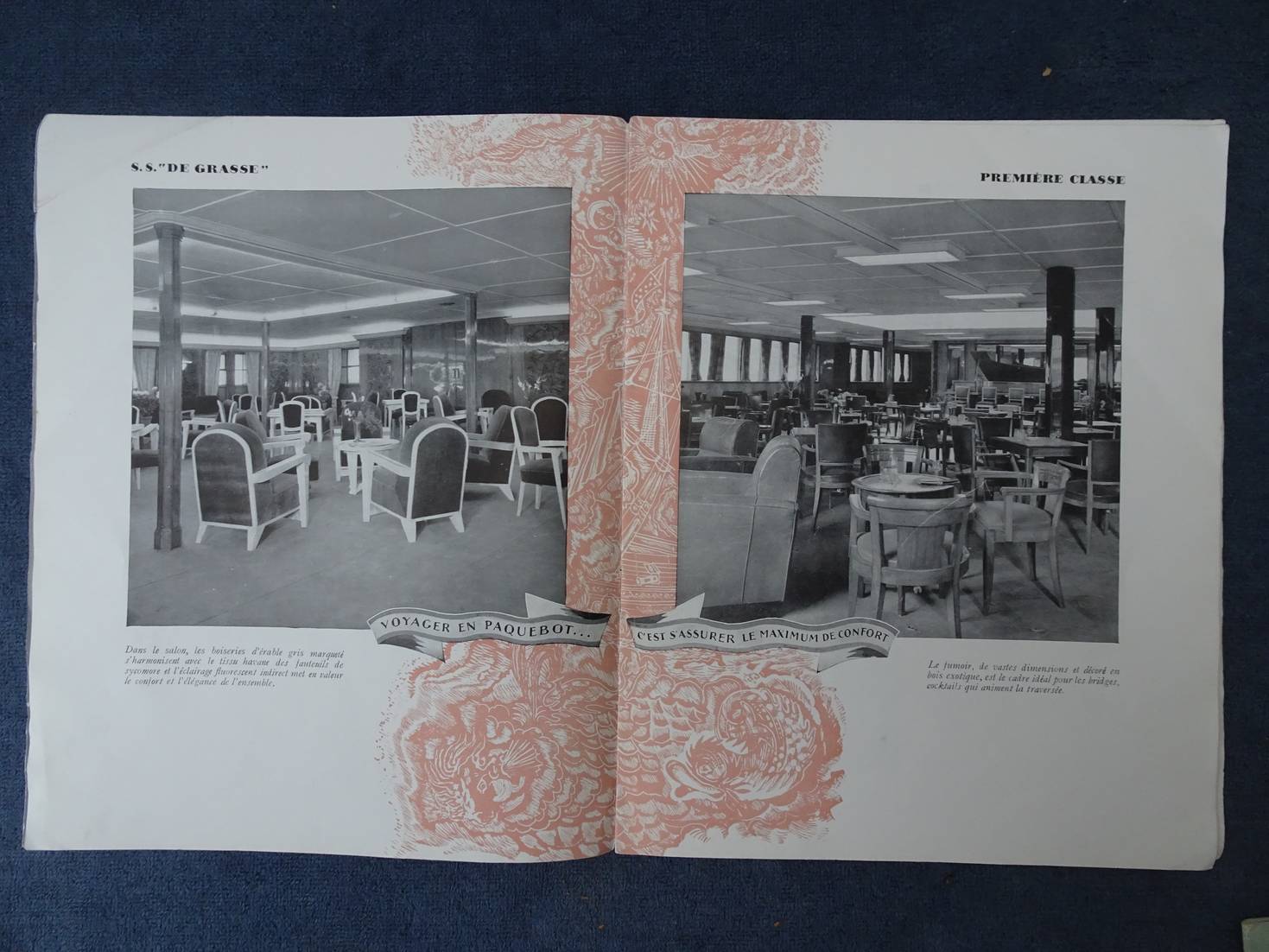
N.n..
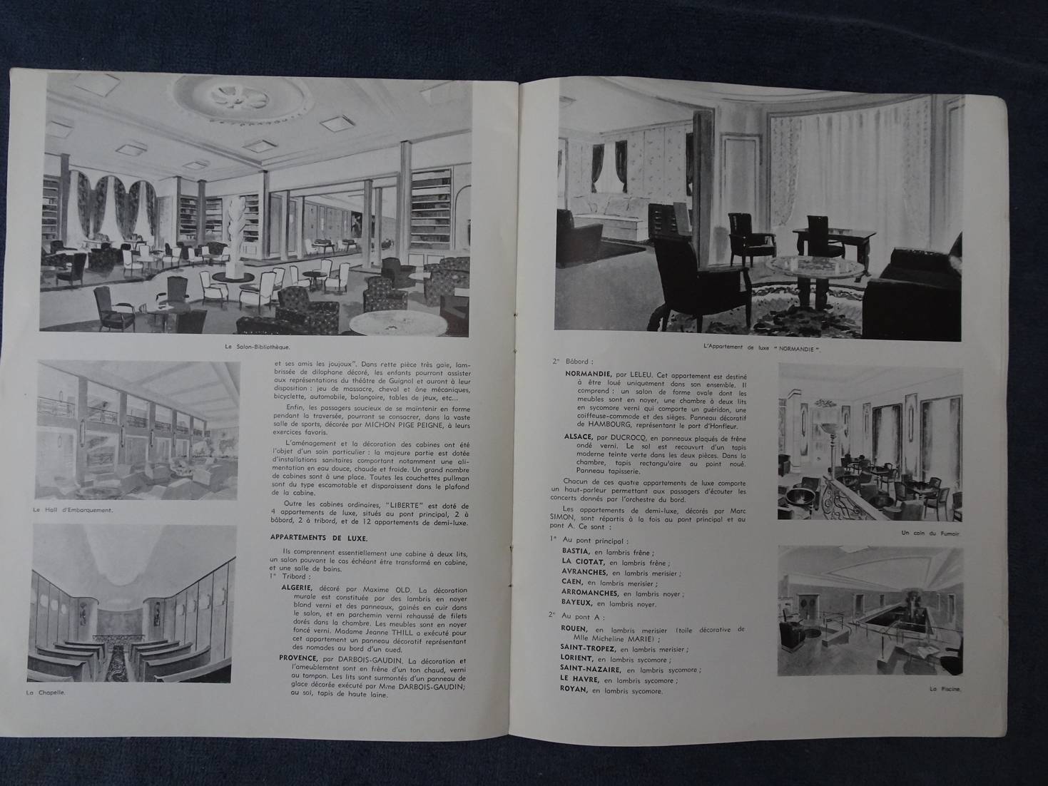
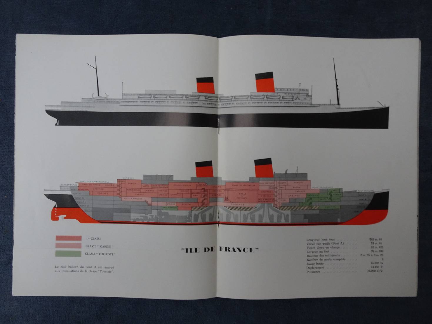
Compagnie Générale Transatlantique. "Liberté", "Ile de France" and "De Grasse".
3 Promotional booklets of the Compagnie Générale Transatlantique; ca. 1940.
In very reasonable condition
[38566]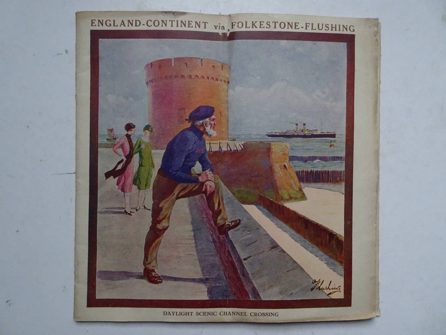
N.n..
England-Continent via Folkestone-Flushing.
S.l.; s.a; softcover; softcover, stapled; tourist guide; 23x23 cm.; ills. in b&w; text in English; advertising throughout; 44 pp.
With fold throught the centre.
[37194]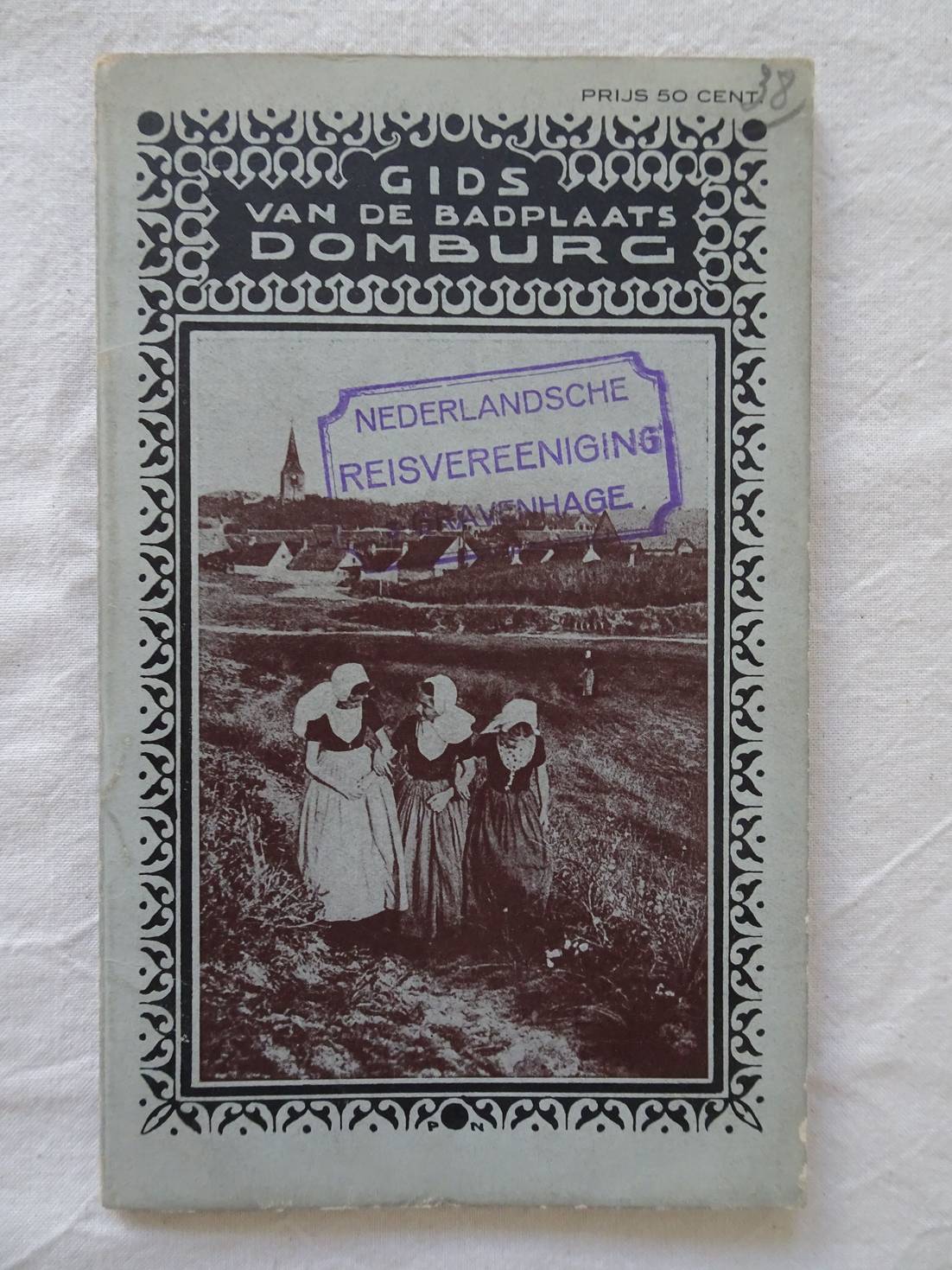
N.n..
Geïllustreerde gids van de badplaats Domburg. Uitgegeven door de Vereeniging tot Bevordering der Belangen van de Badplaats Domburg.
Domburg; 1920; Vereeniging tot Bevordering der Belangen van de Badplaats Domburg; softcover; ca. 10x 17 cm.; ill.; met 2 uitvouwbare kaarten, een plattegrond van Domburg 1920 en een wandelkaart; door het gidsje heen advertenties van lokale ondernemers; 64 p.
Op het voorplat een stempel met de tekst: "Nederlandsche Reisvereeniging 's-Gravenhage". Op de eerste 2 bladzijden enkele kleine stempeltjes Vlaamsche Toeristenbond.
[38786]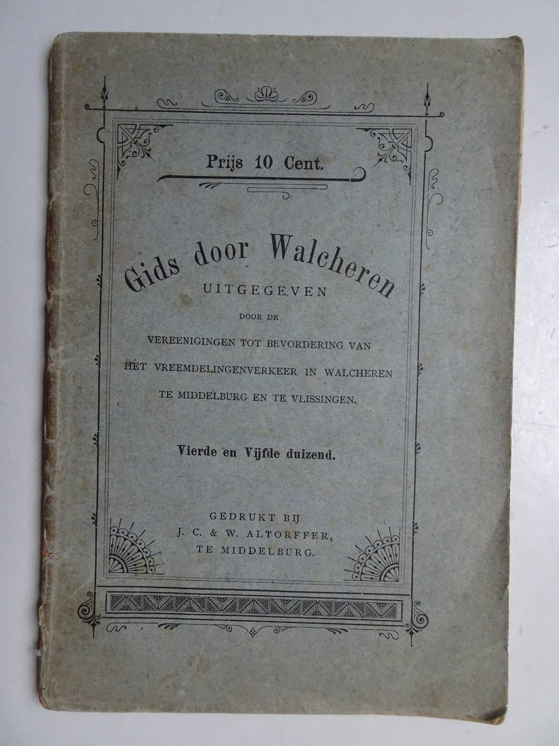
N.n..
Gids door Walcheren, uitgegeven door de Vereenigingen tot Bevordering van het Vreemdelingenverkeer in Walcheren te Middelburg en Vlissingen.
Middelburg; zonder jaar; J.C. & W. Altorffer; zachte kaft; 13x19 cm.; ill., enkele kaartjes en plattegronden, advertenties; 71 p.
Rug iets beschadigd.
[37006]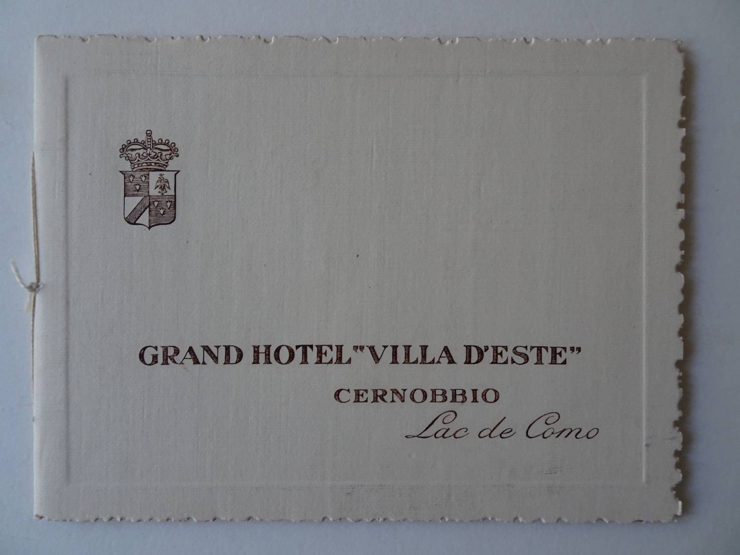
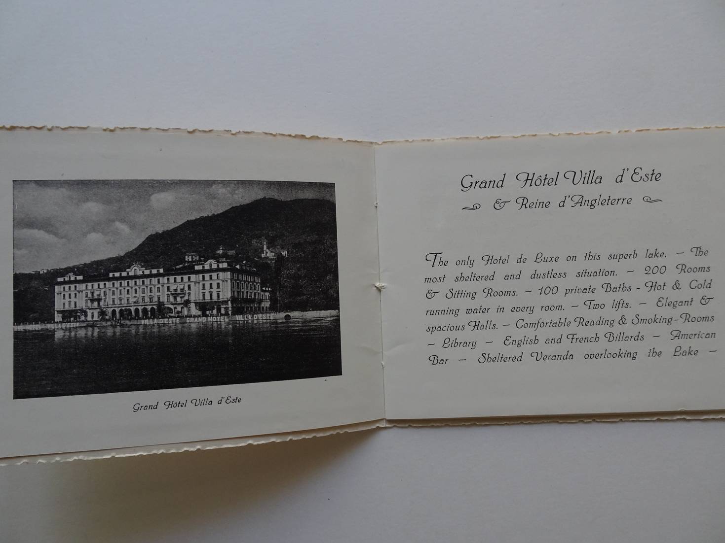
N.n..
Grand Hotel "Villa d'Este" Cernobbio, Lac de Como.
Como; ca. 1926; softcover; 14x 10 cm.; duotone ills.; with a folding map "Carte Routiere"; not paged.
Fine copy.
[39143]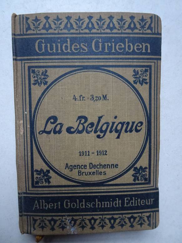
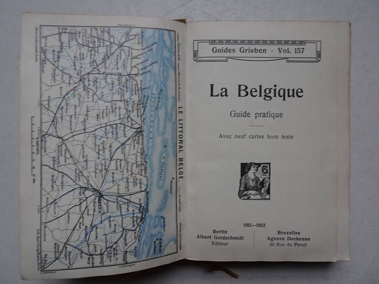
N.n..
Guides Grieben Vol. 157. La Belgique. Guide pratique. Avec neuf cartes hors texte.
Berlin/ Bruxelles; 1911-1912; Albert Goldschmidt/ Agence Dechenne; clothbound; 10x15 cm.; (folding) maps; register; 193 pp.
Slightly worn copy.
[35987]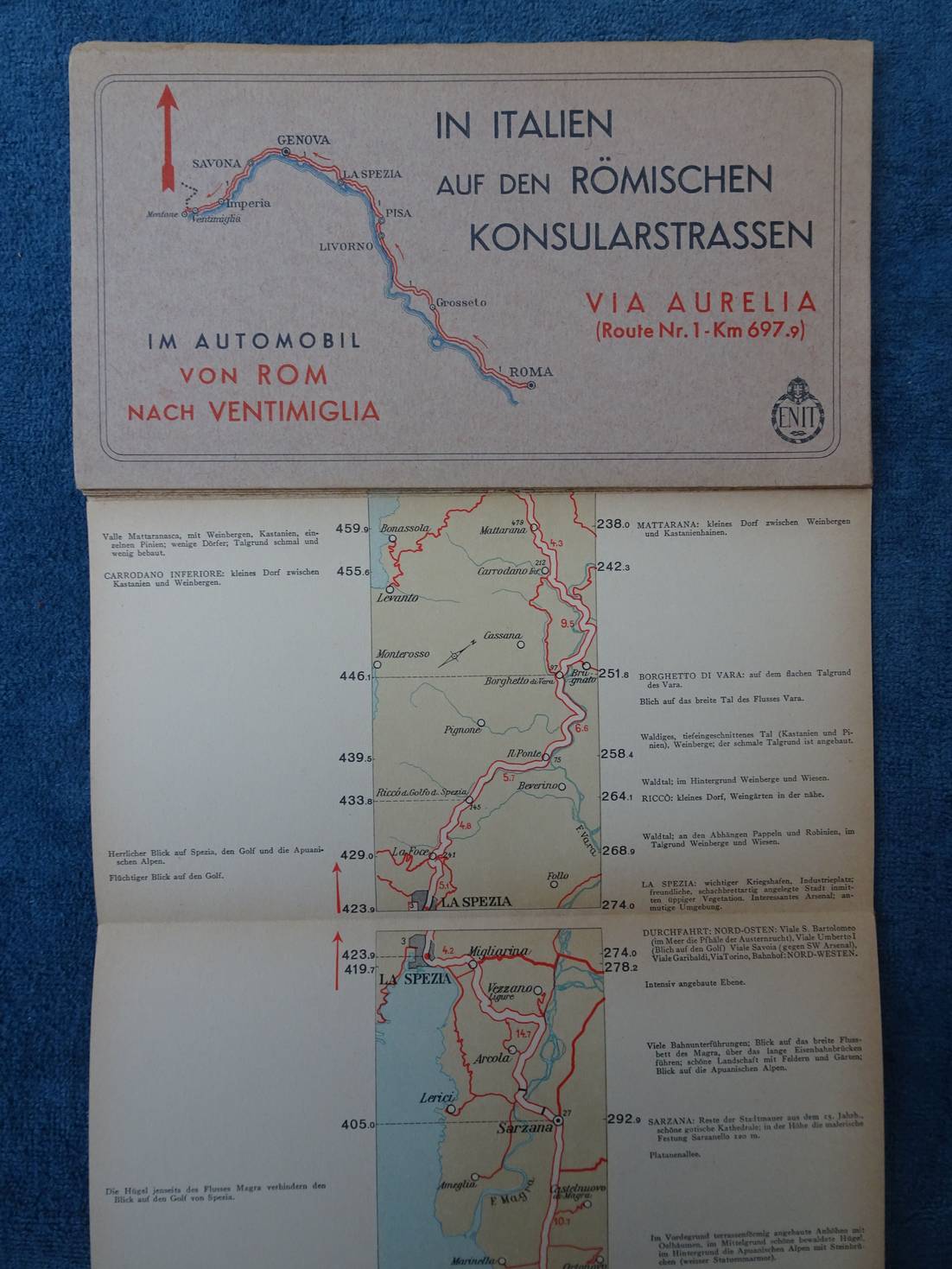
N.n..
In Italien auf den Römischen Konsularstrassen. Via Aurelia (Route Nr. 1- Km. 697.9). Im Automobil von Rom nach Ventimiglia.
S.l.; s.a.; Enit; softcover; oblong; 22x 12 cm.; roadmap; ills. in colour with captions in German; to be unfold like a leporello.
Fine copy.
[38533]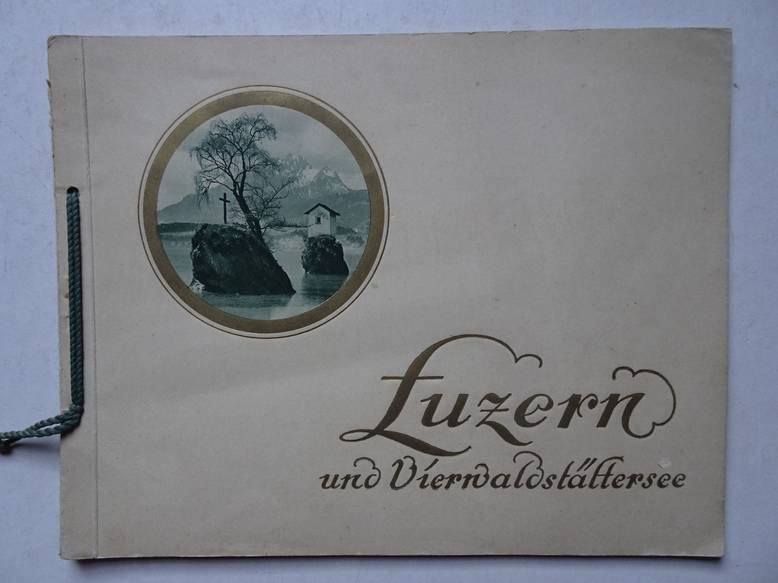
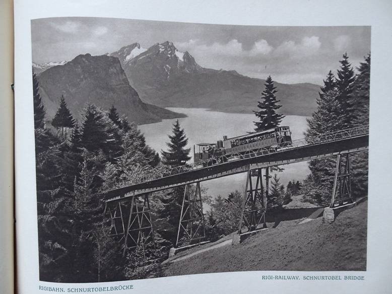
N.n..
Luzern und Vierwaldstättersee. Lucerne and the Lake.
Lucerne; s.a. (ca. 1910); E. Goetz, Édition Artistique; softcover; bound with string; b&w plates; scenic view of Luzern and the Lake; with captions in German and English; not paged.
Fine copy.
[35134]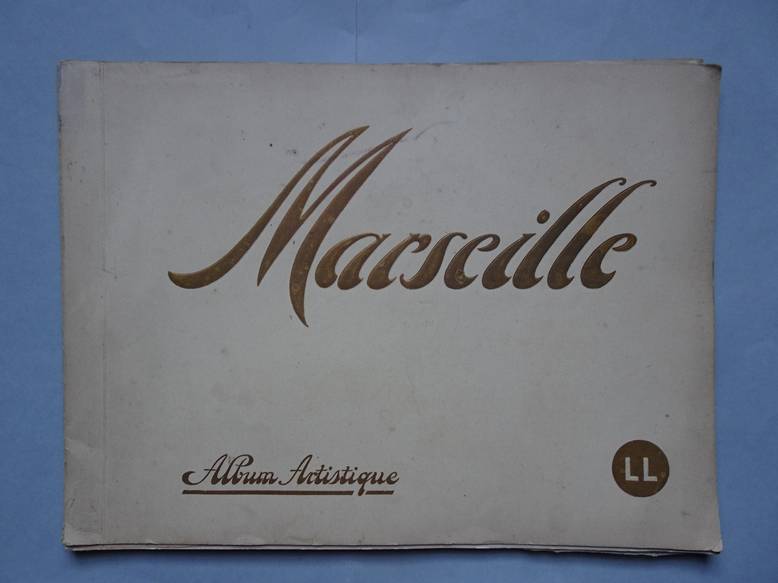
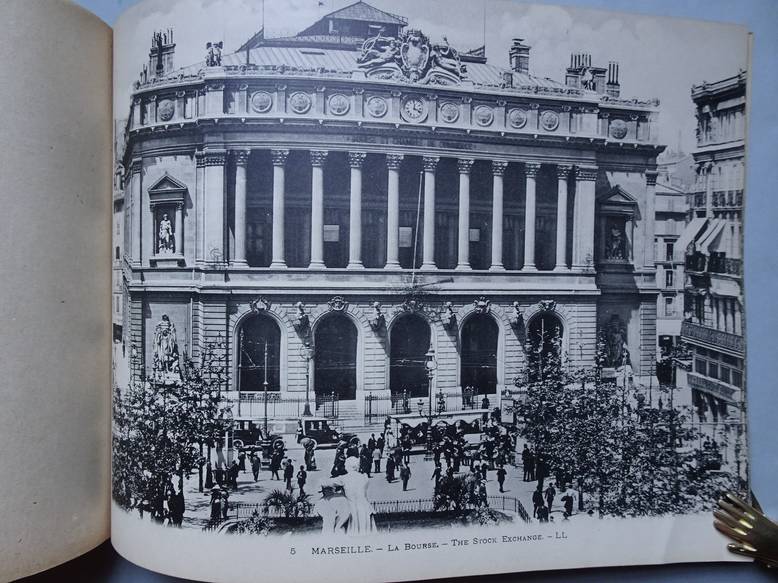
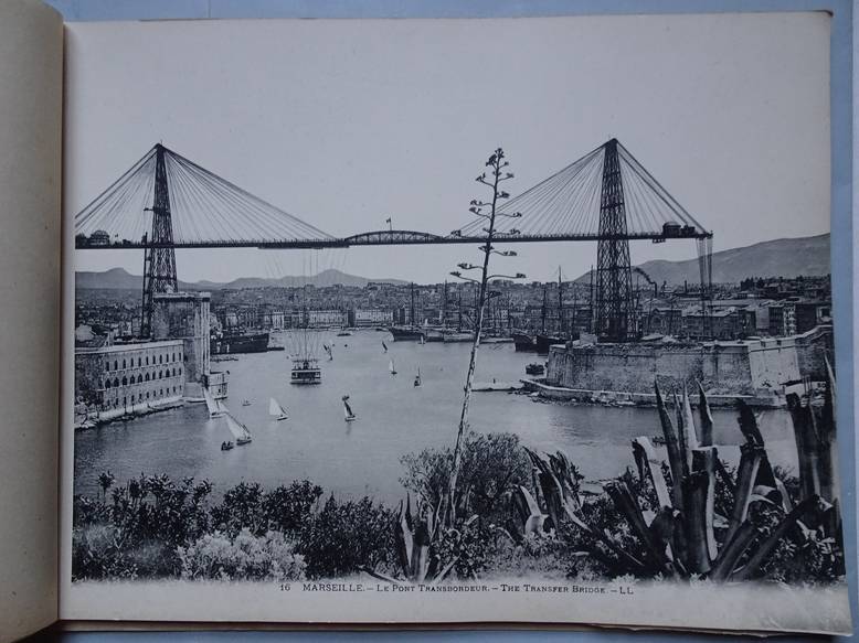
N.n..
Marseille. Album artistique.
S.l.; s.a. (ca. 1910); softcover; oblong; full page photograpic views in b&w of Marseille; with captions in French & English; tissued guards between the pages; not paged.
Bookblock stapled, slightly loosening to the cover.
[35123]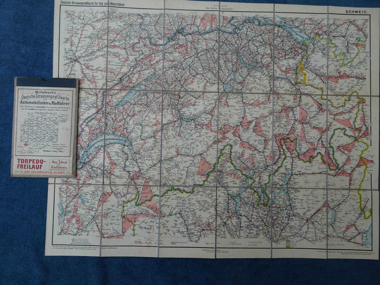
N.n..
Mittelbach's Deutsche Strassenprofilkarte für Automobilisten u. Radfahrer. Schweiz.
Leipzig; no year (ca. 1920); Mittelbach's Verlag; (folding) roadmap, scale 1: 600:000; on cloth; 47x 60 cm.; in matching portfolio (11,5 x 18 cm.).
Fine condition.
[38535]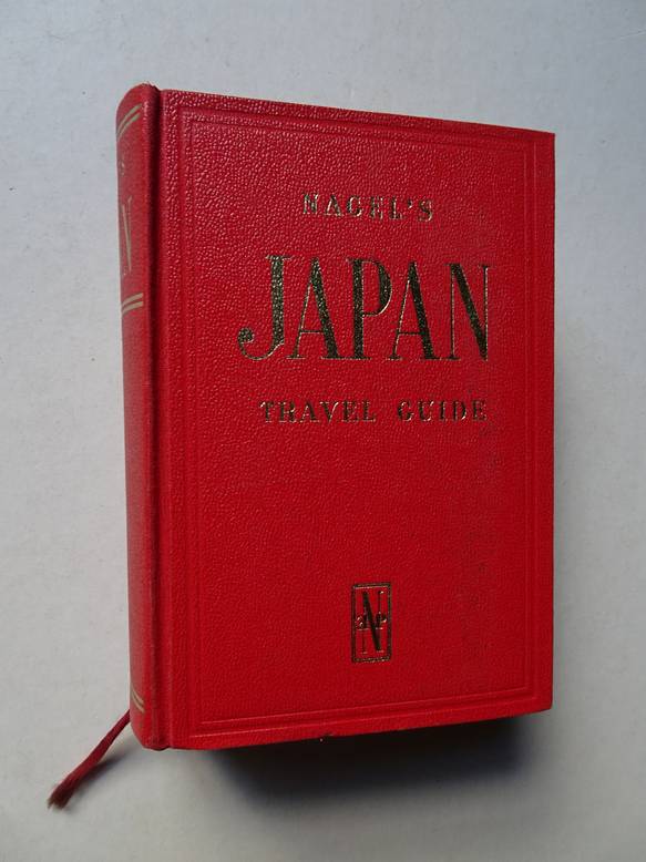
N.n..
Nagel's Japan travel guide.
Geneva, Paris, Munich; 1965; Nagel Publ.; The Nagel travel guide series; ed. by P. Landy and H.S.B. Harrison; 87 black-and-white plans, 44 maps in colours; cloth, gilt stamped; 1120 pp.
Fine copy.
[14531]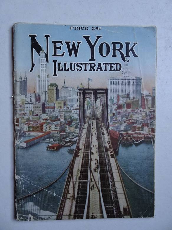
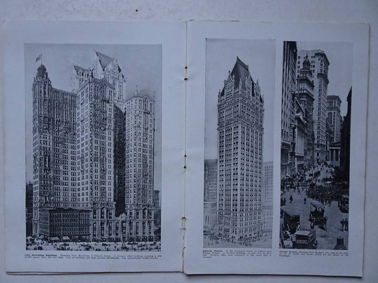
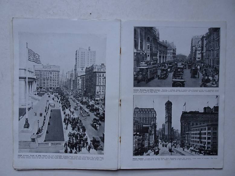
N.n..
New York Illustrated.
New York; s.a. (ca. 1912); Success Postal Card Co.; softcover; stapled; ills. in b&w; depicting views of New York; with captions; not paged.
Cover loose. Staples a trifle loosening.
[35135]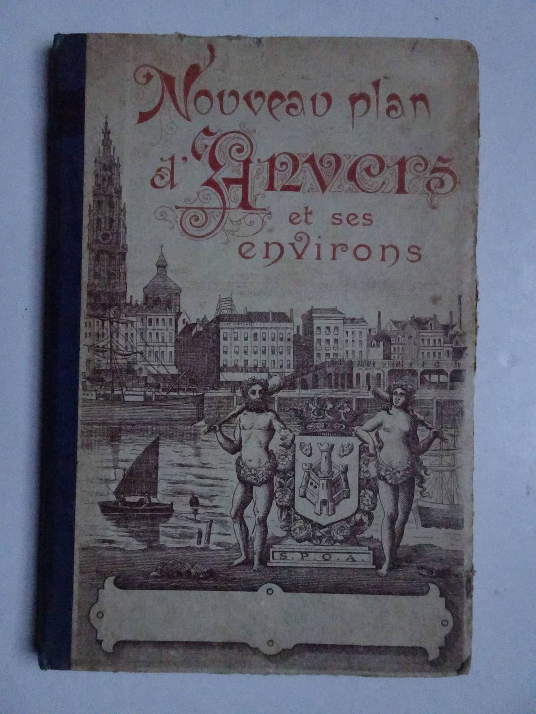
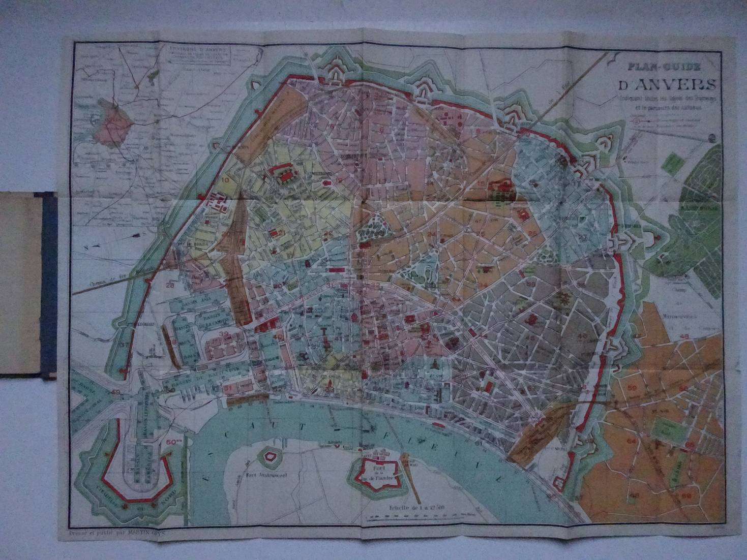
N.n..
Nouveau plan d'Anvers et ses environs.
S.l.; s.a; halfcloth; 10x15 cm.; with folding map; not paged.
Cover a trifle worn along extremities.
[37455]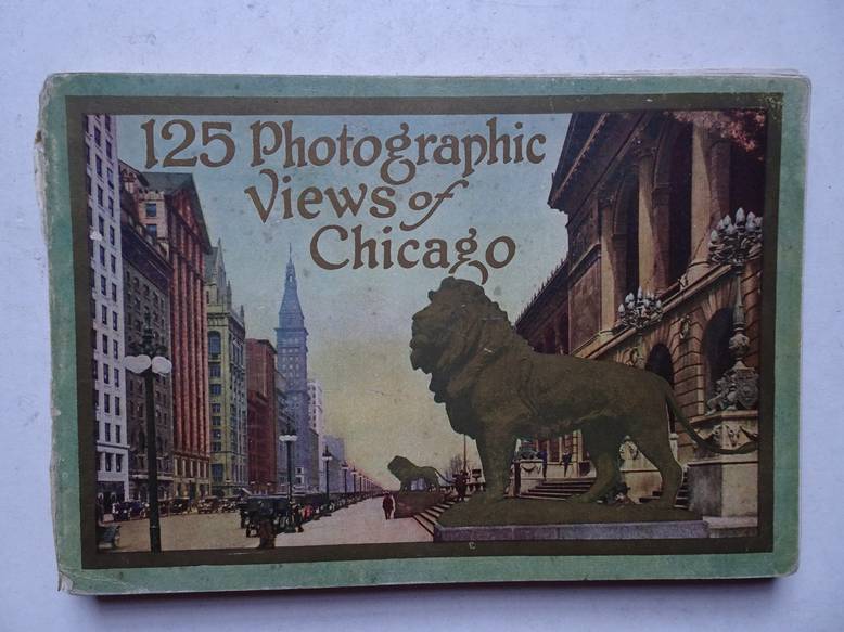
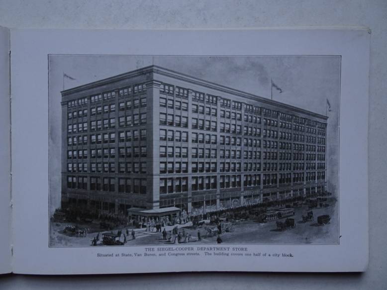
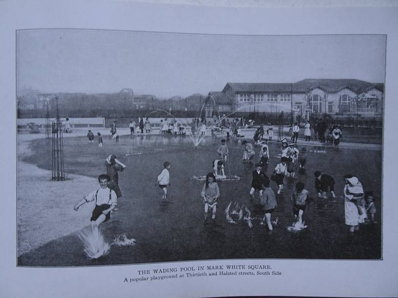
N.n..
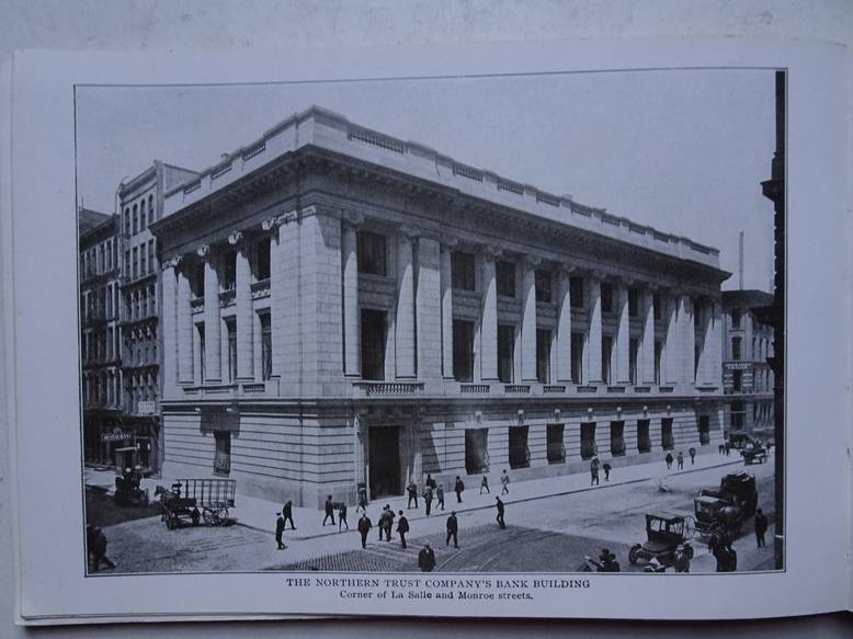
One hundred and twenty-five photographic views of Chicago. A collection of reproductions from photographs of the most prominent streets, buildings, statues, park scenes, and other features of interest in the city.
Chicago/ New York; 1916; Rand McNally & Company Publishers; softcover; oblong; 20x14 cm.; ills. in b&w, views of Chicago, with captions; not paged.
Spine rather damaged. Frontcover a trifle loosening. Backcover slightly stained.
[35120]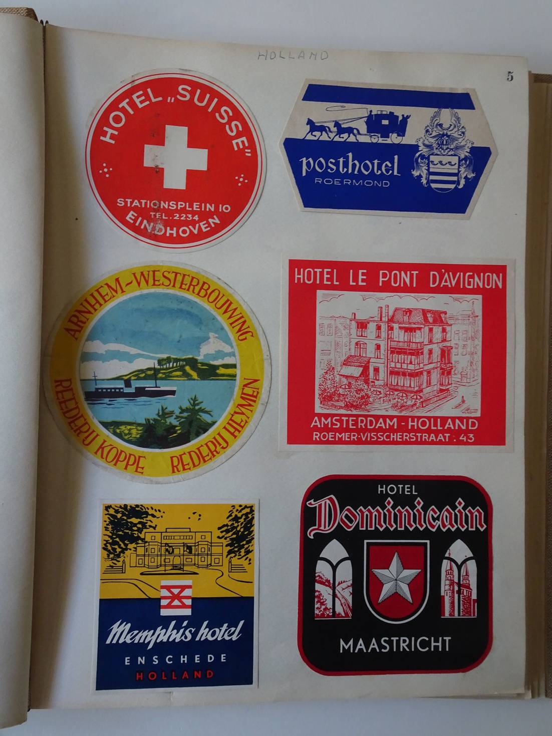
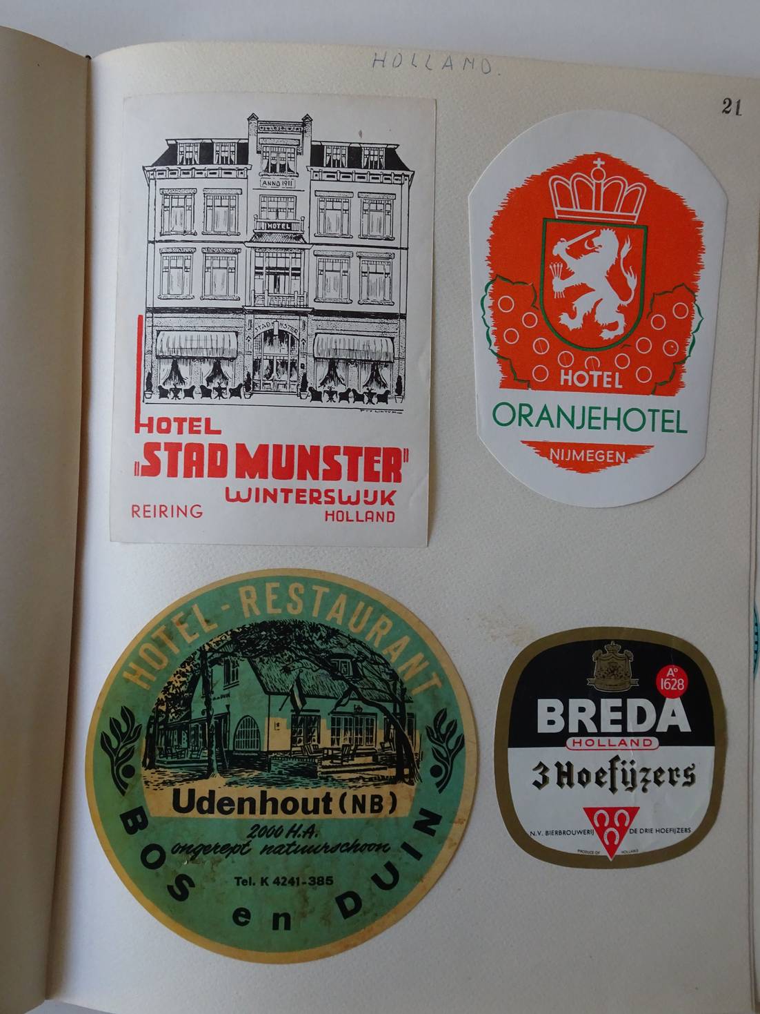
N.n..
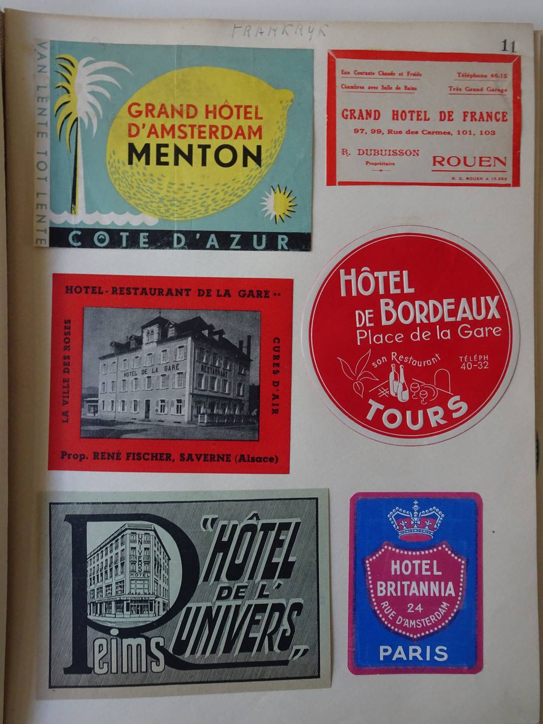
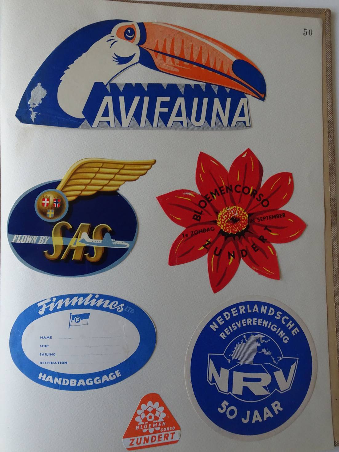
Plakboek met 112 verschillende hotel- en vakantiestickers- labels- en etiketten.
Het plakboek telt 112 ingeplakte stickers/ labels/ etiketten en heeft ook meerdere blanco pagina's om eventueel op- of aan te vullen.
Goede staat.
[39141]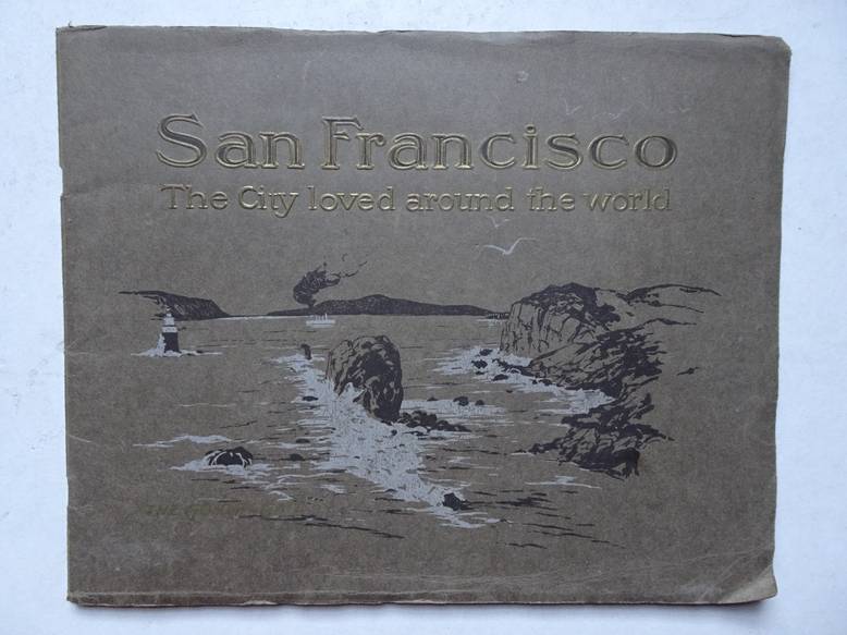
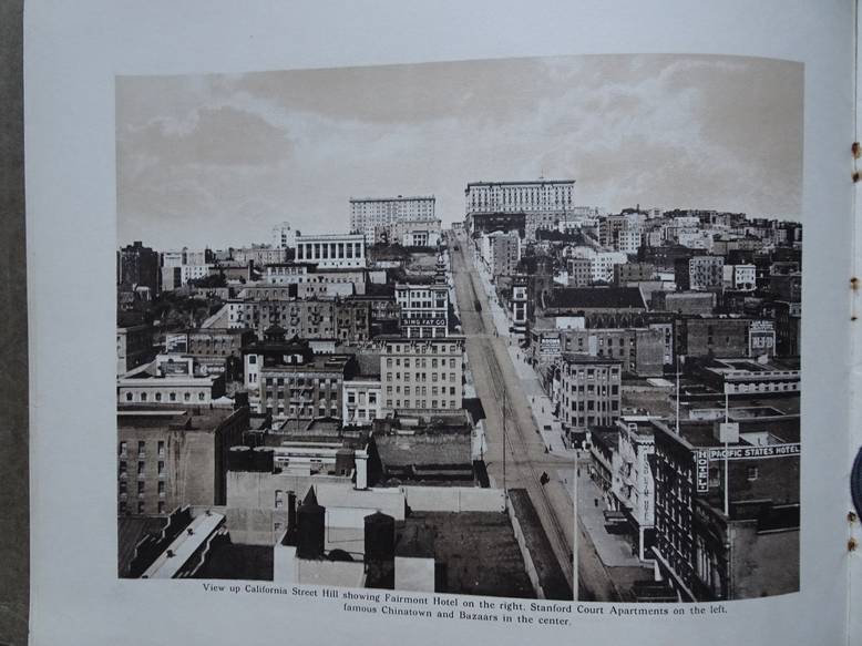
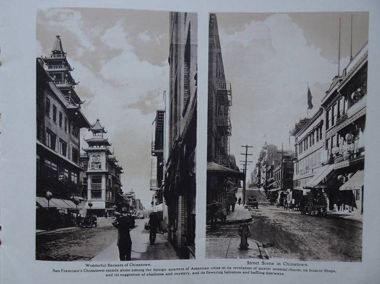
N.n..
San Francisco. The city loved around the world.
San Francisco; 1915; Cardinell-Vincent; softcover, stapled; oblong; b&w ills., with captions; scenic views of San Francisco; not paged.
Near fine copy.
[35127]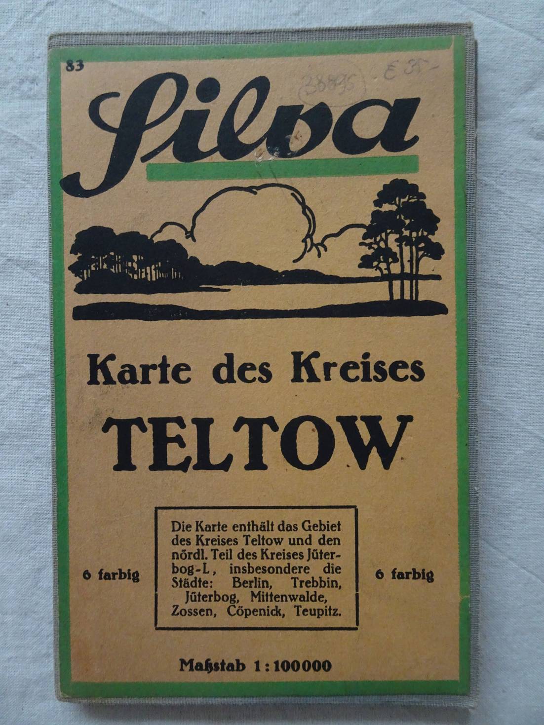

N.n..
Silva Karte des Kreises Teltow. 6 Farbig. Die Karte enthält das Gebiet des Kreises Teltow und den Nördl. Teil des Kreises Jüterbog-L, inbesondere die Städte: Berlin, Trebbin, Jüterbog, Mittenwalde, Zossen, Cöpenick, Teupitz.
Berlin; no year; Willy Holz; folding map, on cloth; Maßstab: 1: 100000.
Fine copy.
[38895]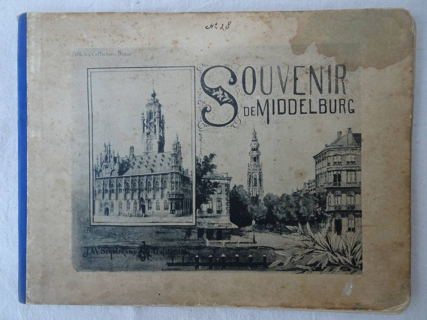
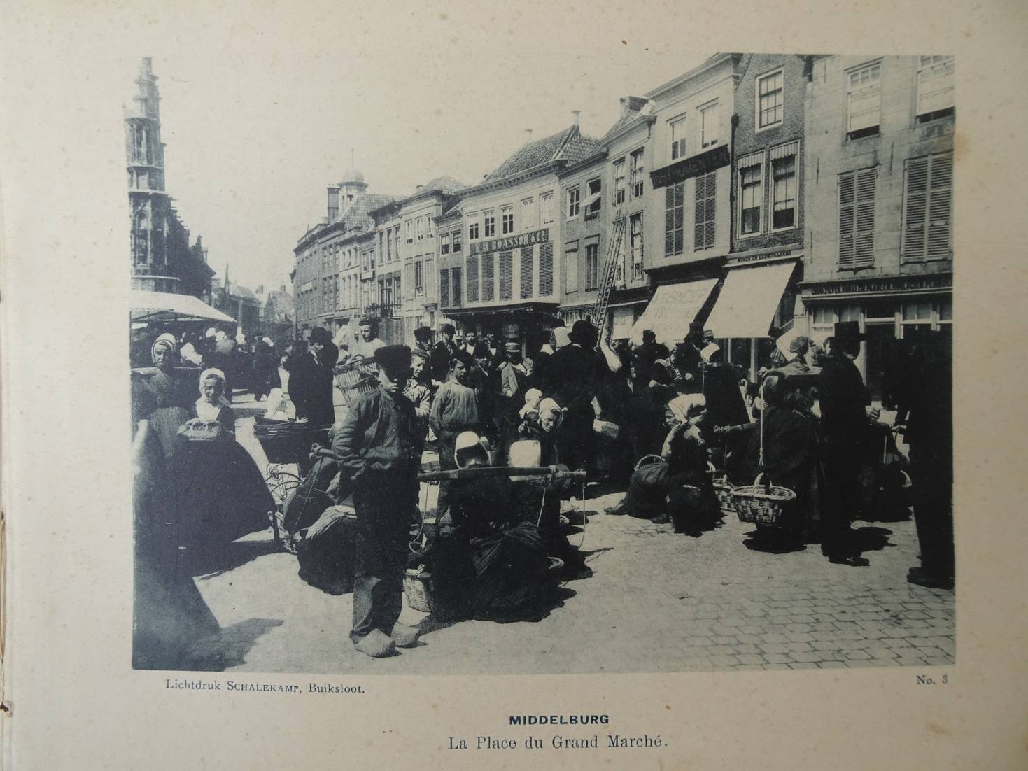
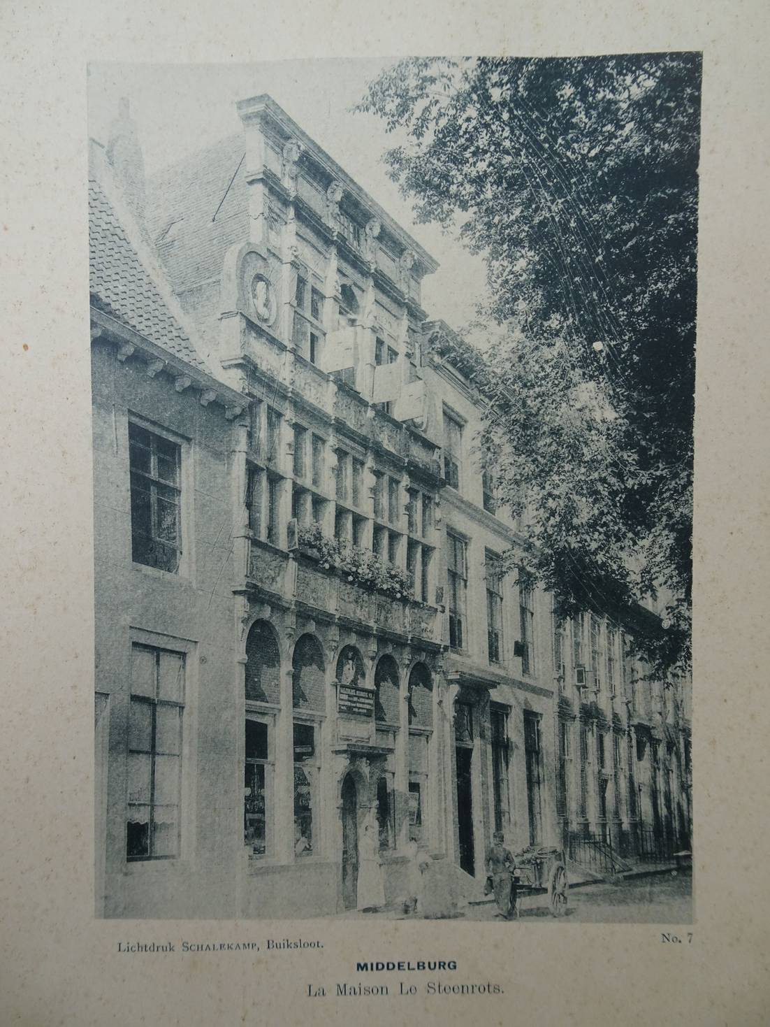
N.n..
Souvenir de Middelburg. Albums, Collection Bleue.
Buiksloot; zonder jaar; J.M. Schalekamp; halflinnen; oblong; 20x15 cm.; met 12 afbeeldingen in lichtdruk, waarvan 1 van het stadhuis van Veere en de andere met betrekking op Middelburg; de tekst onder de afbeeldingen is in de Franse taal.
Vochtvlek op het voorplat en enkele hele kleine roestvlekjes.
[38604]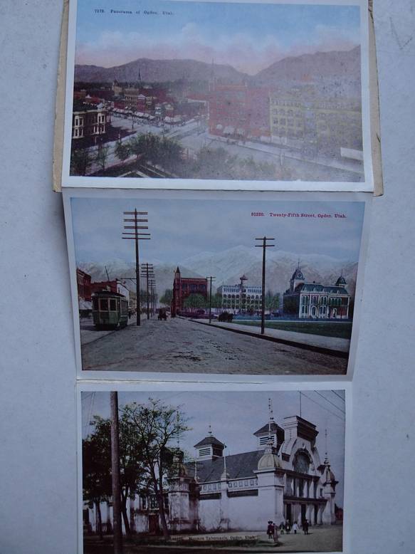
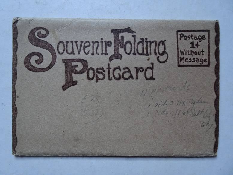
N.n..
Souvenir Folding Postcard. Ogden & Salt Lake City, Utah.
S.l.; s.a. (ca. 1915); 11 movable postcards, recto and verso; in cover; 11 scenic views of Ogden & 11 scenic views of Salt Lake City; all in full colour; 16x10,5 cm.
Fine copy.
[35132]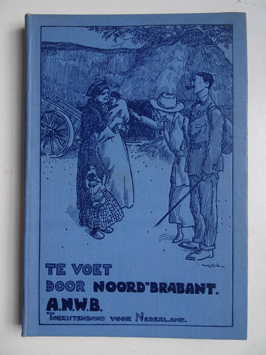
N.n..
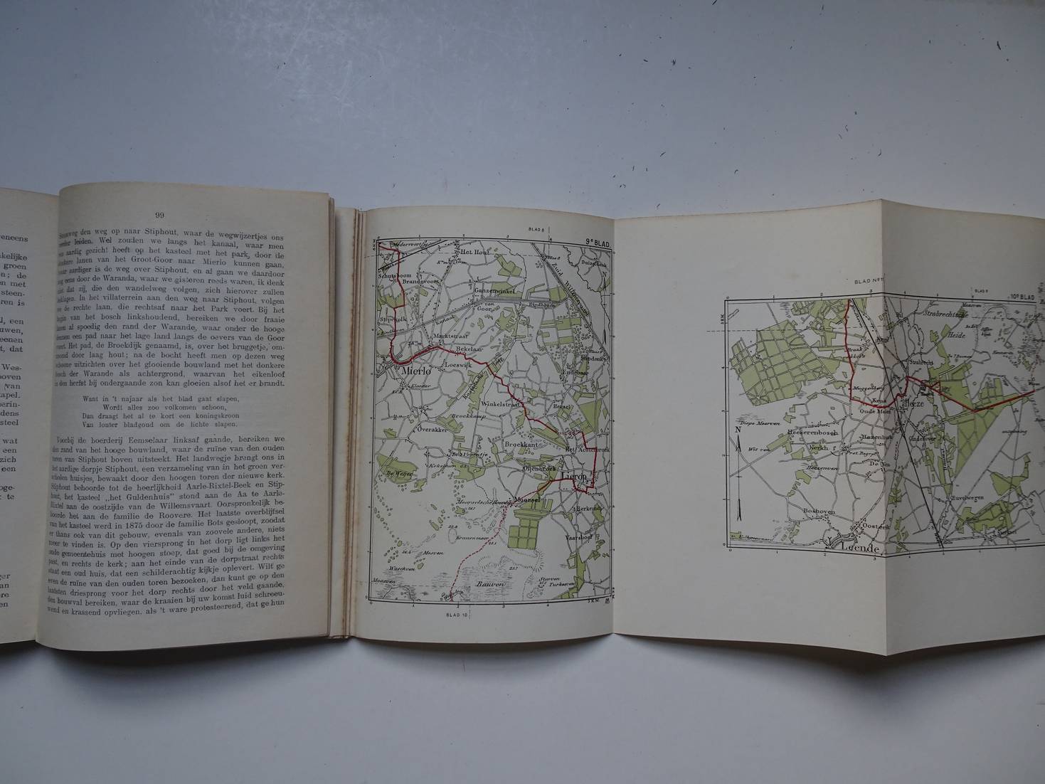
Te voet door Noord-Brabant.
's-Gravenhage/ Amsterdam; ca. 1918; A.N.W.B. Toeristenbond voor Nederland; harde kaft; 1e druk; ill.; 111 p., gevolgd door sectie met uitslaande kaarten.
Goed exemplaar
[36790]